Berthierville
Saint-Barthelemy
Maskinongé
Louiseville
Yamachiche
Pointe-du-Lac
Trois-Rivières
Bécancour
Saint-Célestin
Saint-Monique
Nicolet
Baie-du-Febvre
Pierrevillle
Odanak
Notre-Dame-de-Pierreville
Yamaska
Saint-Robert
Sorel-Tracy
Saint-Joseph-de-Sorel
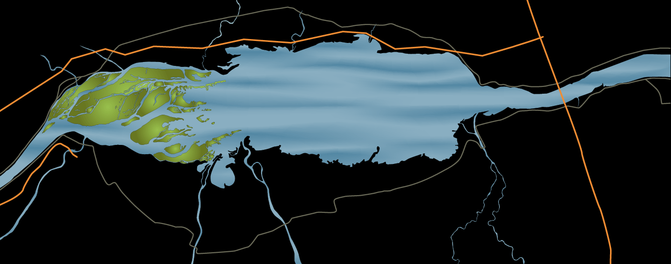
Lake Saint-Pierre
Richelieu River
Yamaska River
Saint-François River
Nicolet River
Yamachiche River
Du Loup River
Maskinongé River
Chicot River
Bayonne River
Baie de Lavallière
138
138
138
138
138
138
132
132
132
132
132
155
155
30
55
55
40
40
40
40
40
Île de la commune de Berthier
Île aux castors
Île Saint-Ignace
Île Dupas
Île Madame
Île Ronde
Île aux Ours
Île de Grâce
La Grande Île
Îles de la Girondeau
Île Plate
Île aux Corbeaux
Île Lapierre
Île des Barques
Île du Moine
Île Bibeau
Île aux Fantômes
Île d'Embarras